Base Level Engineering (BLE) studies are performed for Texas Water Development Board (TWDB) to develop high-level models of largely undeveloped watersheds. This allows under-served communities to have an estimation of the 100-year (1%) storm floodplain extent. Cardinal Strategies was hired as a subconsultant to develop BLE models for HUC 10 sized watersheds for three separate Task Orders. To accomplish this, Cardinal worked with other subconsultants to model entire HUC 8 watersheds, with each subconsultant generally having 1-2 HUC 10s to develop. Strong communication was necessary to achieve milestones on schedule and to coordinate intra-model calibration efforts to accurately convey discharge between models.
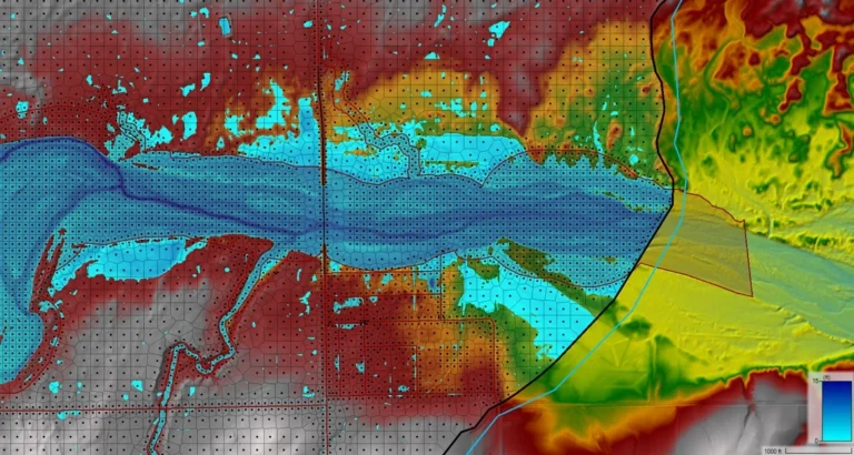
The BLE models were developed using 2D modeling within HEC-RAS. The advantage 2D modeling has over 1D modeling is that it allows large watersheds to be modeled efficiently and with a high degree of accuracy relative to their size. Instead of cutting cross-sections for each tributary and manually calibrating them for each reach, 2D modeling allows for a mesh to be created that utilizes terrain data to determine the flow of water in a more dynamic way through the watershed. Modeling watersheds in 2D also requires less assumptions that are present in both the hydrologic and hydraulic stages of the modeling process, making the results more reliable than 1D modeling would be capable of in many scenarios. Cardinal was responsible for modeling the attenuating effects that roadways, dams, berms, and playa lakes had on the runoff within the modeled watershed. Flows from the watershed were calibrated against USGS gage station data that was using PeakFQ to establish a confidence interval that modeled flows should fall within. Flow data from each model is passed to subsequent downstream models, necessitating regular communication with other subconsultants to ensure that flows fall within established confidence intervals along all gage stations. This is also accomplished by coordinating tie-ins between separate models to seamlessly convey flow data downstream as if a single HUC 8 watershed were being modeled all at once.
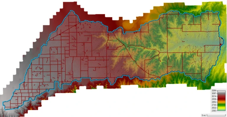
As Cardinal became more proficient with developing HUC 10 sized 2D models with each passing Task Order, Cardinal was assigned an entire HUC 8 watershed to model. The HUC 8 model was comprised of three HUC 10 subbasins that were modeled collectively as one watershed. The same care and attention to detail that Cardinal had for the previous HUC 10 models was shown to this Task Order. Across all three Task Orders, Cardinal has modeled approximately 1,822 square miles of Texas using HEC-RAS 2D methodology.
Downstream portion of HUC 8 Watershed with Urban Area (Terrain with Computation Points)